
McGillivray Falls Trail
Whiteshell Provincial Park
May 30,2020 McGillvray Falls is a short and beautiful hike commonly rated as easy-moderate. The trail can be pretty challenging with a lot of rocky elevation, but even the long loop comes in under 5 kms. It’s a great choice for a quick morning or afternoon hike. This trail is also a part of the Centennial Trail and Blue Highway Mountain Biking Trail, so be sure to pay attention to the signs.
Length: Long Loop: 4.6 km
Short Loop: 2.8 kms
Duration: 2 hours. Signs recommends 3 hours, but I easily finished this hike in 1.5 hours.
Facilities: Non-flush toilets at trail head.
Trail head Location: It takes just under two hours to get to the trail head from Winnipeg. I took the Number 15 highway east, then turned north on Highway 11 until I met Highway 44 that I took east. The trail head is on the right side of Highway 44.
Signage: Mostly metal signs with arrows fastened to the rocks. Occasional blue arrows on trees as well as a few sections where orange tape was used. Examples of all can be seen below. Potential confusion at a few points along the trail as McGillvray Falls Trail is part of two other trails. Pay attention to signage and you shouldn’t have any problems.
Trail condition: It’s a well marked trail throughout with a few sections that are more rugged and rocky with significant elevation. A few areas on the return section of the long loop and the short trail to the end rest area were quite wet and muddy.
Things to note: No cell reception, make sure you remember the way home.
Questions?: I’d love to chat about the hike if you have any questions. Visit the About page to find out how.

Trail head sign at the beginning of the hike.
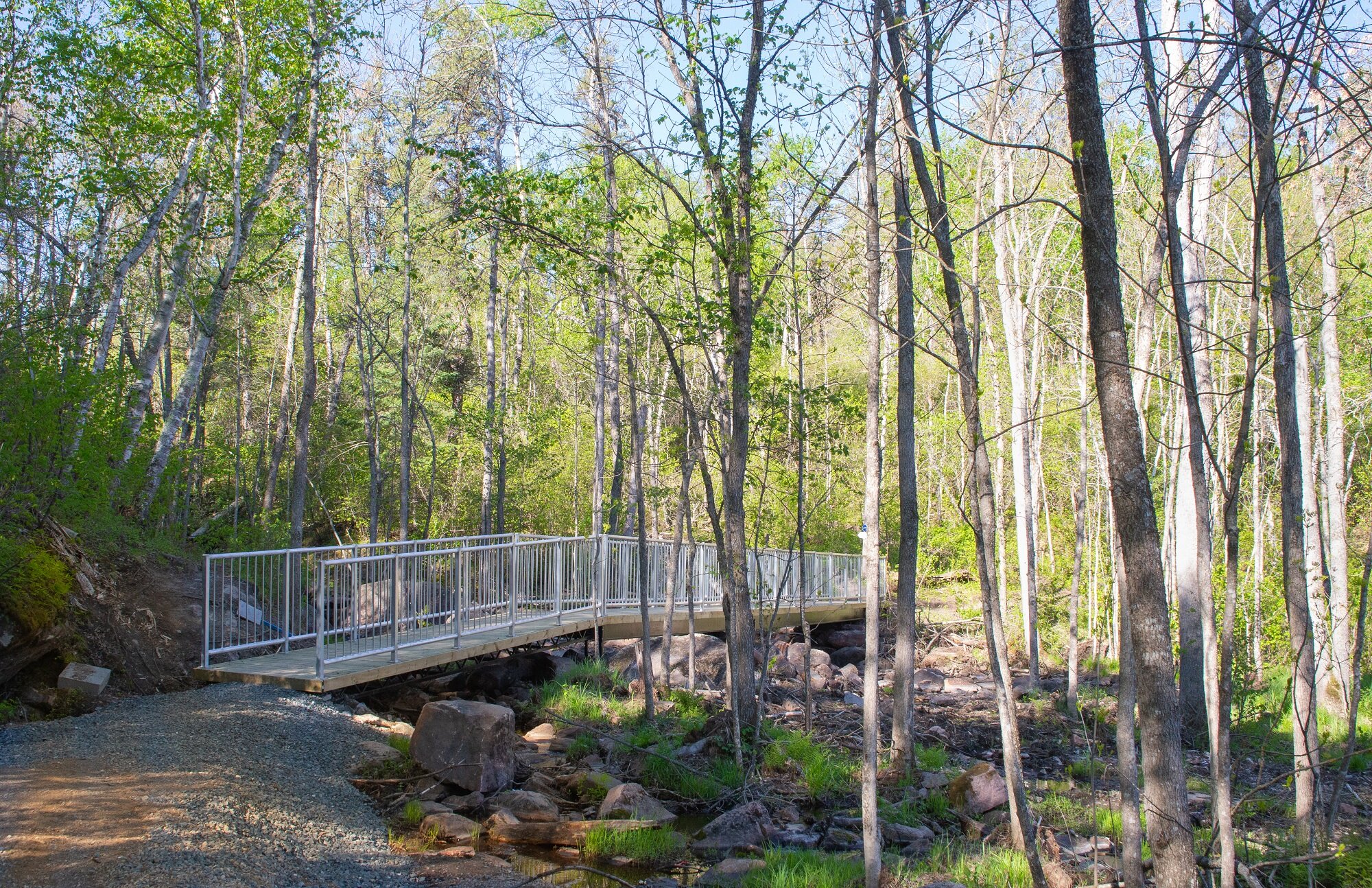
The new bridge installed over McGillvray Falls.

A close up view of the hike.

The wide path leading from the trail head to the falls.

Most of the signage is self explanatory, but the Mcgillvray Falls hike is a part of a couple of other longer trails, so be mindful!

A view of the McGillvrary Falls from the bridge.

I stopped and played around with some longer exposure shots of the falls.

An example of what the trail can look like with some rocky elevation.

I stopped and played around with some longer exposure shots of the falls.

This was the kind of signage I saw most along the way.

The view across the water from the top of the falls.

Another example of the different environment types the hike crosses.

Rocky but well groomed trails.

Another example of trail signs to keep your eyes peeled for.

There's a portion just after the falls where you're faced with a gorgeous wide view of the river leading to McGillvray Lake.

There's a portion just after the falls where you're faced with a gorgeous wide view of the river leading to McGillvray Lake.

It was pretty wet and mucky when I was there, wear proper footwear if you're not sure if it has dried up.

This is where you can either take the shorter 2.8 km loop, or the longer 4.6 km loop.

There are some small bridges and short steep elevation up and down.

An old sign in desperate need of a paint job.

The trail eventually leads you to McGillvray Lake. Lots of gorgeous views across the water.

The small rest stop at the very end of the trail. You need to break off the loop and continue along a short back and out trail to get here.

The trail eventually leads you to McGillvray Lake. Lots of gorgeous views across the water.

As well as the rest stop, there's also a fire pit with a helluva view.